- Chambatalenthunt2013@gmail.com
-
 +91-9816631006, +91-9418333592
Famous for Sach Pass
Pangi Valley in Chamba district of western Himalayan state of Himachal Pradesh, India is one of the remote tribal areas and represent temperate climate with harsh weather condition during winter. The entire valley is distributed over an area of 1503 km. Geographically valley deals with north – eastern part of the Chamba district and is bounded on the north by spur know as Trishul dhar, which separate it from the Paddar area of Jammu and Kashmir. On the south, there is a ridge joining Ghor Dhar Jot and running up to Dhandal Dhar, where it meets the range of Pir-Panjal. The eastern range touches with the Zanskar range of the main Himalayan. The valley lies in the semiarid zone of the inner-Himalayan and thus withnesses severe winters and heavy snow fall. The region is drained by Chenab river, which is also known as Chandrabhaga.
There are several beautiful valleys in Pangi, the principle being Sural, Hudan, Sachu and Parmar, all leading upto the Zanskar Range. The lowest limits of Pangi near the Sansari nala are at 2000m, while most of the Pangi valley is between 3,000 and 4,000m. The upper limits of the ridges separating Pangi from Zanskar and from Chamba are mostly between 5,000 and 6,000m. In general the entire area is rugged, step and rocky.
The human population density of Pangi is low (9/km) compared to the rest of the state (109/km) Agriculture is the mainstay of the population that live in 65 villages (16 Panchayats) spread across the valley. The primary crops in the valley are wheat, barley, maize, phullan (Fagopyrum emagrinatum) bres (F. esculentum) and siul (Amaranthus anardana) bres and phullan were the traditional crops in the region. Merely (1.4%) of the geographical area of the region is reported to be under cultivation Mixed Board Leaved Forest of Pangi Valley. Cedrus deodara, Betula utilis, Pinus wallichiana, Corylus jacquemonti, Pinus gerardiana, Celtis australis, Aesculus indica, Juglans regia, Acer negundo. Among the forest, maximum area is occupied by Mixed Broad leaved Forest (36.08%).
The north –western region of Pangi is dominated by Mixed Broad leaved Forests. The forests near Pontu, Killar, Sansari, Perigran and Lujj localities have having domainace of coniferous species like C.Deodara, P.wallichiana and P. gerardiana while those around Pindru, Saach and Khilmi, are dominated by species.
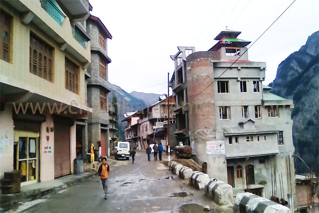
Full of grandeur and tribal majesty is the land locked valley of Pangi, 173 km from Chamba via Sach Pass (4414 m). It is one of the sub-division of Chamba district surrounded by the Peer Panjal & Zanskar ranges. Killar is the sub-divisional headquarter of Pangi Valley. Beyond the reach of tropical monsoon rains, the valley is one of the off-beat challenging tourism destinations in the State. Approach to the Pangi valley is across the high mountain passes like Sach, Chehni and Rohtang Pass. The Valley is remained land locked for about six months due to heavy snow fall.
There are beautiful valleys within Pangi region like Sural, Saichu, Kumar-Parmar, Hundan and Sechu. All these valleys are connected with Zanskar. People of Pangi valley are mainly Hindu with a small population of Buddhist. Some people live in higher reaches of the valley called Bhatoris such as Sural Bhatori, Hundan Bhatori, Parmar Bhatori, Chasak Bhatori and Hilu-Twan. There are number of exciting treks from Pangi valley to Keylong (Lahaul valley), Manali (Kullu) and Kishtwar in Kashmir.
Pangi Valley is now connected by road from Chamba via Sach Pass (4414 m) and from Manali via Rohtang Pass (4116 m) and Lahaul valley. Best season to visit Pangi valley is between May to October.